Salar de Uyuni: Bolivia’s Salt Desert, Ancient Lakes, and Mirror of the Sky
A landscape that changes with the seasons
In southwestern Bolivia, an immense white plain stretches towards the Andean horizon. This is Salar de Uyuni, a place that can resemble a frozen sea in one season and a vast reflection of the sky in another. Its unusual appearance has made it a memorable destination, but its deeper importance lies in the relationship between geology, water, climate and scientific observation. The salar is neither a conventional desert of sand nor a permanent lake. It is a salt flat: a broad basin where minerals remain after water evaporates. Understanding this distinction transforms the visit from a search for dramatic photographs into an encounter with the long history of the South American highlands. The landscape becomes more impressive when its apparently simple white surface is understood as the result of many natural processes.
Where the salar is located
Salar de Uyuni lies on the Altiplano, the high plateau of the central Andes, at an elevation of roughly 3,600 metres above sea level. NASA identifies it as the largest salt flat on Earth, covering approximately 10,000 square kilometres. Different scientific descriptions report somewhat different area measurements because survey methods and mapped limits vary. Mountains frame the plain, while nearby basins and volcanic landforms reveal a much more complex geography than photographs of the white interior suggest. This is a region of strong sunlight, large temperature changes and thin high-altitude air. Those conditions shape how people experience the landscape and how its surface develops. They also explain why a journey to Uyuni calls for different preparation from a visit to a coastal city. Even short walks can feel different at this elevation.
The vanished lakes beneath the story
The salar is a reminder of lakes that once occupied large parts of the Altiplano. During wetter periods in the distant past, water accumulated in enclosed basins. As conditions changed, some lakes retreated, leaving dissolved minerals behind. Repeated episodes of evaporation and mineral deposition gradually created the extensive salt crust. NASA describes the region as a landscape shaped by several prehistoric lakes, including the ancient lake commonly known as Minchin. Geological evidence, such as sediment layers, former shorelines and the composition of mineral deposits, helps researchers reconstruct that history. The salt flat is therefore an archive of environmental change. Its seemingly motionless surface records processes that unfolded over thousands of years. Rather than imagining a lake that disappeared in a single event, it is more accurate to think about a long series of changing water levels and chemical conditions.
Why the surface is so flat
One of Uyuni’s most remarkable properties is its extraordinary flatness over a very large area. Seasonal water can spread across the crust and help dissolve and redistribute salt. When the water retreats, minerals crystallize again. This recurring process helps maintain a broad, level surface, although the salar is not perfectly featureless. Scientists have measured subtle variations in height that may be invisible to an ordinary visitor. Such consistency across a large area is useful for satellite observation. Researchers use the salar as a natural reference for checking instruments that estimate elevation and analyze reflected light. An area celebrated for its visual beauty is therefore also valuable as a practical outdoor laboratory. The next time a satellite image shows the brilliant white basin, it is worth remembering the scientific work that this unusual surface helps make possible.
Salt polygons and the geometry of nature
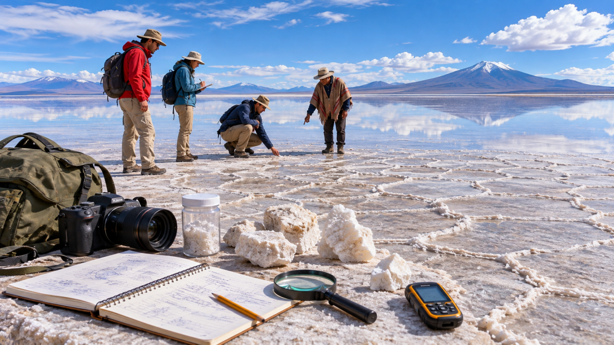
During drier conditions, visitors may notice lines that divide the ground into polygonal patterns. Some shapes appear nearly hexagonal, producing an intricate mosaic that can stretch far into the distance. These are natural patterns associated with the behaviour of salty water, the movement of moisture and the growth of mineral crust. The common mineral halite, familiar as sodium chloride, forms an important component of the surface. NASA also identifies gypsum among the minerals present. The white landscape may look uniform from a distance, but its small-scale texture varies from place to place. Looking closely at a crust ridge, a shallow depression or a change in surface colour reveals a complex material environment. The geometry offers an accessible way to introduce students to crystallization, evaporation and the relationship between physical conditions and visible patterns.
How the famous sky mirror appears
The reflective effect associated with Salar de Uyuni requires a particular combination of conditions. When seasonal rainfall leaves a shallow layer of relatively still water on sections of the salt flat, the surface may reflect clouds and distant mountains. Because the land is exceptionally flat, the reflection can seem unusually continuous. The result is sometimes described as a meeting between earth and sky. Yet the effect is never guaranteed on a specific day. Rainfall varies, wind can disturb the water, and some routes become inaccessible when flooding is extensive. A visitor who understands those limits will avoid treating any photograph as a promise. The dry-season crust and the wetter-season reflection are two different expressions of the same environment. Both deserve attention, and neither is less authentic than the other.
A landscape visible from space
Uyuni is readily recognizable in satellite imagery because of its size, brightness and distinctive shape. The European Space Agency has highlighted the flat surface as useful in calibrating radar altimeters, instruments designed to measure height from orbit. NASA has likewise described its value for testing and checking satellite sensors. The connection between the landscape and space science is especially engaging for young readers. Satellites observe the Earth from great distances, yet they depend on places with well-understood characteristics to test their measurements. Uyuni supplies one such reference. Changes in water coverage can also be followed through images collected at different dates. Comparing those images teaches a broader lesson: remote sensing is not merely a way to produce striking pictures, but a method for observing environmental processes over time.
Planning a thoughtful visit
The nearby town of Uyuni serves as a common starting point for journeys into the surrounding salt flat. Travellers should verify current conditions with reputable local operators and suitable official information rather than assuming every route will be accessible. High altitude deserves particular attention: a gradual pace, adequate rest, hydration and an itinerary that avoids unnecessary strain can make the experience more comfortable. Strong sunlight and a reflective white surface call for suitable eye and skin protection. Cold conditions may occur even when the day begins brightly. Weather, transport arrangements and access restrictions are variable, so practical details need checking shortly before departure. Visitors should also carry necessary personal supplies and ensure that transport plans fit the terrain. Responsible planning is not an obstacle to wonder; it is what allows a memorable journey to unfold calmly.
Respecting a fragile setting
A salt flat may look so expansive that individual actions seem unimportant. In reality, a responsible visit means using established routes, following qualified local guidance and avoiding unnecessary damage to surface formations. Natural mineral patterns should not be removed as souvenirs. Waste belongs in suitable collection facilities rather than on the plain. Photography should never require unsafe driving or disregard for temporary restrictions. The surrounding communities also contribute essential knowledge about conditions, navigation and daily life in a high-altitude environment. Choosing services carefully and listening to local advice can improve both safety and understanding. This approach suits family travel as well as educational visits. It treats the salar not as an empty backdrop made for visitors, but as a distinctive environment that deserves continuing care.
Conclusion: more than an extraordinary photograph
Salar de Uyuni combines a rare visual experience with lessons in geology, hydrology and Earth observation. Ancient lakes helped leave its mineral deposits; seasonal water continues to change its appearance; and its remarkably level surface supports scientific measurements made far above the ground. For Arab readers interested in Latin America, the salar offers an accessible introduction to the Andes beyond familiar images of mountains and forests. It invites comparison with the importance of water and arid landscapes in many parts of the world, while remaining a place with its own specific history. The most lasting encounter may come not from a perfect reflection, but from recognizing how the white plain connects deep geological time, present-day weather and the careful work of understanding our planet.